New


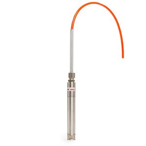
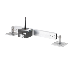
MLRemote
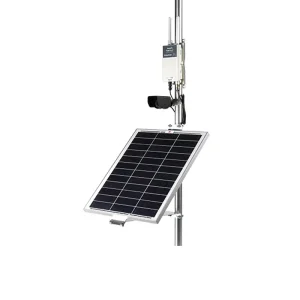
The Canary Systems® MLRemote® is a low-power, point-to-multipoint, programmable wireless datalogging system designed for demanding environments. The system was purpose designed for the mining, geotechnical, structural and environmental markets where the monitoring assets consist of numerous types of instruments, distributed over a large area, and are difficult to access.
Use of proprietary communication “push” technology allows for ultra-long battery life, between 3-5 years for the standard alkaline batteries, up to 10-years when using Lithium cells. The unit can easily be placed in a variety of remote locations for long-term monitoring applications. With fewer components, MLRemote systems are less of a target on sites where theft is a concern compared to the larger, more visible, and expensive alternatives.
The high performance spread spectrum radio is available in 900MHz or 2.4GHz frequencies, and a range of up to 100km (60 miles) is possible with use of gain antennas and excellent topography. Range of up to 15km (9 miles) is easily achievable using the standard antenna and most topography.
Description
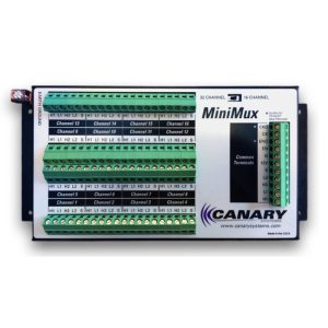
Numerous sensor types are supported, including vibrating wire, 4-20mA, and linear potentiometer. Pulse and frequency measurements, along with digital status monitoring, are also supported with the integrated digital inputs. Integrated digital inputs allow for controlling other sensors and peripherals such as the optional MLMux5 multiplexer supports two switching modes, 5-channel by 4-wire switching, or 10-channel by 2-wire switching.
Digital sensors are also supported including MDT Smart Link-485s and HART 4-20mA sensors, among others, through use of the integrated serial port. A switched power connection also provides for managing power for connected peripherals.
Additional information
| Brands |
|---|
Reviews (0)
About brand
Canary develops a web-based software platform that aggregates geotechnical/geomechanical data from numerous sources into a single platform that provides analytics and other tools including automated alarming and reporting. Canary also develops and sells electronic hardware consist of Dataloggers, Data acquisition systems & Multiplexers for a variety of applications related to weather, water, energy, gas flux and turbulence, infrastructure, and soil.
Data Sheets
Related products
IPX IN-PLACE EXTENSOMETER
In stock
The In-Place Extensometer (IPX) offers automated monitoring of standard magnetic extensometer installations. The system is designed for a simple, adaptable installation with a single cable connection at the top of the borehole. Its large measurement range accommodates large levels of settlement or heave, and ease of adjustment means it can be reconfigured for changed site conditions such as embankment filling or cutting.
VWPHT-3600 SERIES
In stock
The VWPHT-3600 series High Temperature Piezometers are suitable for the extreme environments of temperature and pressure found within applications such as geothermal heat and enhanced oil recovery systems including steam assisted gravity drainage (SAGD) and cyclic steam stimulation (CSS). They are capable of monitoring high temperatures up to 250°C and pressures up to 34.5 MPa.
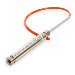
PRESSURE TRANSDUCER VWT-9000 SERIES
In stock
The Geosense® VWT-9000 Series of Pressure Transducers are designed to be connected directly into hydraulic or pneumatic pressure lines by means of a 1/4” BSPF thread. Other thread sizes are available on request.
They are typically used to monitor uplift pressures within dams and to enable manual standpipe piezometers to be upgraded into an automated data acquisition system.
TRIAXIAL TILT SENSOR NODE
In stock
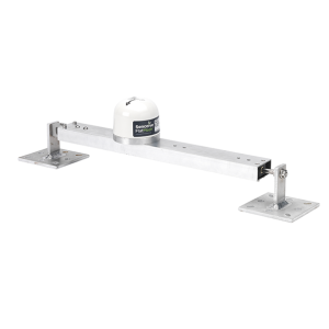
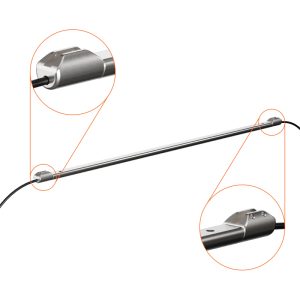
TILT BEAM
In stock
The Tilt Beam is a lightweight, rigid aluminium beam that is used in conjunction with a Triaxial Tilt Node, a NanoPlus or a NanoMacro.
The tilt beam has been successfully used in many applications, including:
- Movement monitoring of any structure
- Longitudinal settlement
- Tunnel convergence/divergence
- Lateral displacements
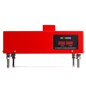
PENDULUM SYSTEM
In stock
HPS-3500 (Hanging) and IPS-3000 (Inverted) Pendulums are used to measure the tilt or rotation by measuring the relative internal horizontal displacement of points along a true vertical line. Each has a tensioned, stainless steel wire and the effects of the earth gravitational forces to guarantee a perfectly vertical line between a fixed point and a tensioning mechanism. Typical applications include concrete dams, bridges and high rise buildings.
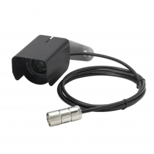
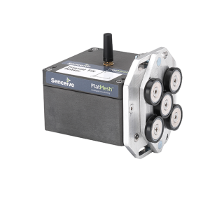
IMAGING & CAMERA
In stock
The FlatMesh 4G Camera is a best in class solar powered solution for static imagery in remote or industrial areas.
It contains a monochrome digital camera which can take clear, high quality photographs day or night without the use of external illuminators.
The 4G camera connects to a Senceive EdgeHub (with FlatMesh) unit which provides power and connectivity over the cellular network (2G/3G/4G) or existing wired ethernet networks.
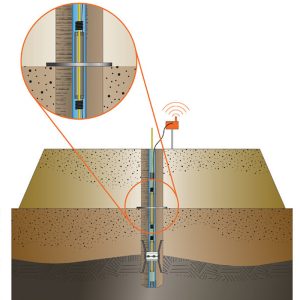
MAGNETIC EXTENSOMETER GXM RANGE
In stock
The GEO-XM settlement system is a magnet extensometer system used typically to monitor settlement and heave in foundations, excavations and embankments.
Data received identifies the depth and position where settlement has occurred as well as the total amount of settlement.
It can also be installed behind retaining structures, such as sheet piles and slurry walls, and above underground openings, such as tunnels and shafts.
Reviews
There are no reviews yet.