


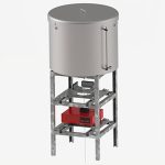
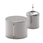
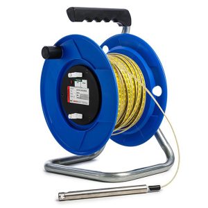

PENDULUM SYSTEM
HPS-3500 (Hanging) and IPS-3000 (Inverted) Pendulums are used to measure the tilt or rotation by measuring the relative internal horizontal displacement of points along a true vertical line. Each has a tensioned, stainless steel wire and the effects of the earth gravitational forces to guarantee a perfectly vertical line between a fixed point and a tensioning mechanism. Typical applications include concrete dams, bridges and high rise buildings.
Description
The HPS-3500 Hanging Pendulum has a fixed point high up in the structure and a heavy weight is used to generate the tension. The weight is submersed in a fluid to damp movements that may be caused by currents of air up through the pendulum shaft.
The IPS-3000 Inverted Pendulum has a fixed point at, or below, the base of the structure and employs a large float in a water filled tank, to generate the tension in the wire.
Measurement of the position of the vertical wire, relative to the structure allows rotation or tilt to be calculated.
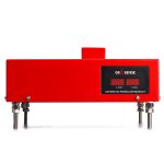
Displacements relative to the wire are measured using a manual readout or, for remote reading, the TP-2000 automatic readout is used.
Additional information
| Brands |
|---|
Reviews (0)
About brand
Geosense Ltd is one of Europe’s leading manufacturers and suppliers of instruments to the geotechnical, civil engineering, mining and environmental industries.
Geosense products are used globally in major projects in more than 68 countries. With a comprehensive in-house design and manufacturing capability, we can provide products not only to tight deadlines but also to suit custom-engineered solutions for specific project requirements.
Geosense specialises in the manufacture of vibrating wire and MEMS sensors, which are used to produce a wide range of instruments. In addition we manufacture automated data acquisition systems to complement our sensors, including wireless systems.
Data Sheets
Related products
BOREHOLE ROD EXTENSOMETER
In stock
The Geosense® GEO-XB2 borehole rod type extensometer range is used to measure and locate settlement, displacement and deformation in soil and rock.
It consists of a reference head and one or more in-hole anchors each of which is placed at a known depth and connected to the reference head by either a rigid or flexible rod running inside a flexible sleeve, which keeps the rod de-bonded from the grout.
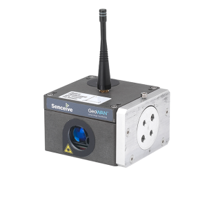
OPTICAL DISPLACEMENT SENSOR NODE
In stock

NANO TRIAXIAL TILT SENSOR
In stock
The Nano range uses the same core platform as our other tilt sensors, so it can deliver a similar level of performance and reliability, all in a small and robust enclosure. Nanos have been successfully used in many applications, including:
- Tunnel distortion
- Tunnel heave/settlement
- Embankment slippage (used in conjunction with stake mounts)
- Structural movement
- Rail track heave/settlement
- Rail trackbed cant and twist
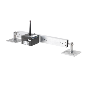
TRIAXIAL TILT SENSOR NODE
In stock
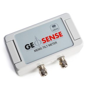

IN-PLACE TILT METER MEMS
In stock
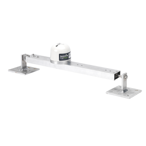
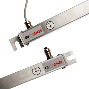
TILT BEAM
In stock
The Tilt Beam is a lightweight, rigid aluminium beam that is used in conjunction with a Triaxial Tilt Node, a NanoPlus or a NanoMacro.
The tilt beam has been successfully used in many applications, including:
- Movement monitoring of any structure
- Longitudinal settlement
- Tunnel convergence/divergence
- Lateral displacements
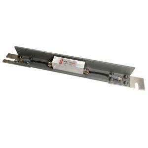
TILT BEAM MEMS
In stock
MEMS Tilt Beams are designed for attachment to structures, on either a vertical or horizontal surface, for the measurement of tilt or differential settlement.
They consist of a highly accurate MEMS sensor housed in a fully sealed enclosure which is mounted on a lightweight rigid GRP beam. This can be mounted onto the structure using special anchors. The GRP beam has a very low coefficient of thermal expansion meaning that thermal affects are minimised.

INCLINOMETER CASING XC
In stock
Reviews
There are no reviews yet.