
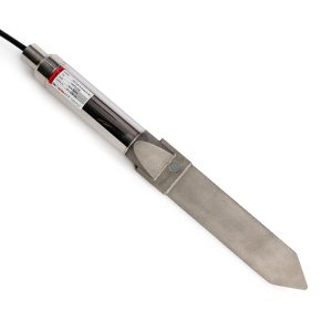

TDR PORTABLE READOUT
Lightweight, Portable and Powerful
The MLTDR-P is field-configurable for Cable Channel, Cable Length and Cable Velocity (Vp).
A 12AHr lead-acid battery provides power, recharging is accomplished via the power port on the side of the reader and a supplied charging cable. Communications are provided via RS232 interface through the supplied cable. There is an optional Bluetooth interface available, on request.
Description
Time Domain Reflectrometry (TDR) is increasingly being used in geotechnical applications for deformation monitoring in soils and concrete. It provides accurate location information for faults and can provide indication of the static or dynamic nature of the faults. It is typically used to monitor slope movement of embankments including highway cuts, rail beds, bridge abutments and open pit mines.
TDR technology was originally developed by the telecommunications industry as a method for detecting faults, or breaks, in cables. The principle is similar to radar, where a signal is broadcast and distant objects cause a portion of the signal to be reflected back towards the generator. By measuring the time between transmission and reception, and knowing the speed at which the signal is traveling, accurate determinations of the distance can be calculated.
In TDR applications the signal is an electrical pulse broadcast down a coaxial cable, and changes in the impedance of the cable, either inductive or capacitive, cause reflections to be returned to the signal generator. The resultant reflections are measured and presented as a function of time, the time is translated to distance based on the known propagation velocity of the cable being utilized. In geotechnical applications the coaxial cable typically takes the form of a rugged coaxial cable with a diameter of 12mm (0.5”). The cable is usually grouted into a borehole drilled into the embankment to be monitored. Any movement of the embankment will crimp the cable, and the reflections indicate approximate magnitude of the crimp and the location. The resolution is related to the number of samples of data being collected for the waveform.
Data returned by the electronics is referred to as a reflection coefficient, or percentage of reflection, and is in a range of 1 (open circuit) to -1 (short circuit). A value of zero indicates no reflection. Typically, with very long cables there is some absorption of the signal down the length of the cable which shows as an increasing reflection coefficient. Deformations or abnormalities in long cable lengths will still result in an increase or decrease in the reflection coefficient at those locations. A sample data output is provided below.
All distances are “apparent”, not absolute. A key configuration parameter of the monitoring system is the velocity of propagation (Vp), this is the percentage of the speed of light that the electrical signal travels down the cable. Vp typically ranges between 0.65 and 0.90 but these are approximate values supplied by the manufacturer. In-situ modification of the cables, using a few crimps applied to the cable at measured distances during installation, can be useful to help establish more accurate distance measurements. Contact Canary Systems® for more information on this technique.
Additional information
| Brands | |
|---|---|
| Datalogger |
CR6 |
| Universal Channels |
12 |
| Input Voltage Range |
+/-5V |
| Digital Ports |
16 |
| Communications |
Ethernet, USB, CS I/O, RS-232, CPI, RS-485, SDI-12 |
Reviews (0)
About brand
Canary develops a web-based software platform that aggregates geotechnical/geomechanical data from numerous sources into a single platform that provides analytics and other tools including automated alarming and reporting. Canary also develops and sells electronic hardware consist of Dataloggers, Data acquisition systems & Multiplexers for a variety of applications related to weather, water, energy, gas flux and turbulence, infrastructure, and soil.
Data Sheets
Related products
OPTICAL DISPLACEMENT SENSOR NODE
In stock

NANO TRIAXIAL TILT SENSOR
In stock
The Nano range uses the same core platform as our other tilt sensors, so it can deliver a similar level of performance and reliability, all in a small and robust enclosure. Nanos have been successfully used in many applications, including:
- Tunnel distortion
- Tunnel heave/settlement
- Embankment slippage (used in conjunction with stake mounts)
- Structural movement
- Rail track heave/settlement
- Rail trackbed cant and twist
SUBMERSIBLE TILT METER
In stock
IN-PLACE INCLINOMETER (IPI)
In stock
IPI-X IN PLACE INC – EXT
In stock
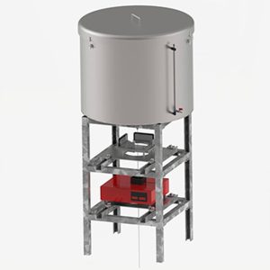
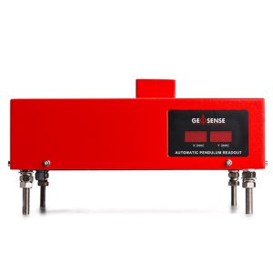
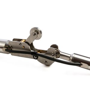
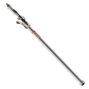
PENDULUM SYSTEM
In stock
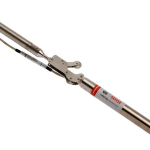
HPS-3500 (Hanging) and IPS-3000 (Inverted) Pendulums are used to measure the tilt or rotation by measuring the relative internal horizontal displacement of points along a true vertical line. Each has a tensioned, stainless steel wire and the effects of the earth gravitational forces to guarantee a perfectly vertical line between a fixed point and a tensioning mechanism. Typical applications include concrete dams, bridges and high rise buildings.
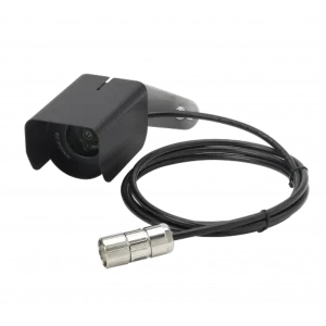
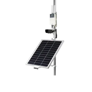
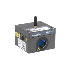
IMAGING & CAMERA
In stock
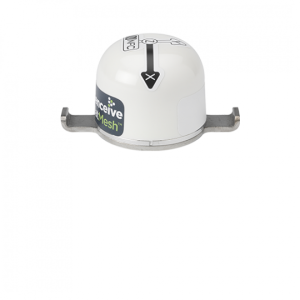
The FlatMesh 4G Camera is a best in class solar powered solution for static imagery in remote or industrial areas.
It contains a monochrome digital camera which can take clear, high quality photographs day or night without the use of external illuminators.
The 4G camera connects to a Senceive EdgeHub (with FlatMesh) unit which provides power and connectivity over the cellular network (2G/3G/4G) or existing wired ethernet networks.
MAGNETIC EXTENSOMETER GXM RANGE
In stock
The GEO-XM settlement system is a magnet extensometer system used typically to monitor settlement and heave in foundations, excavations and embankments.
Data received identifies the depth and position where settlement has occurred as well as the total amount of settlement.
It can also be installed behind retaining structures, such as sheet piles and slurry walls, and above underground openings, such as tunnels and shafts.
Reviews
There are no reviews yet.